Where you are
Athens: The City Between the Mountains and the Sea
Athens is far more than the Acropolis. It is an ancient city and a modern capital at once, set in a basin ringed by mountains and opening south to the Saronic Gulf, with a cluster of bare hills rising like balconies over the urban grid.
More than the rock
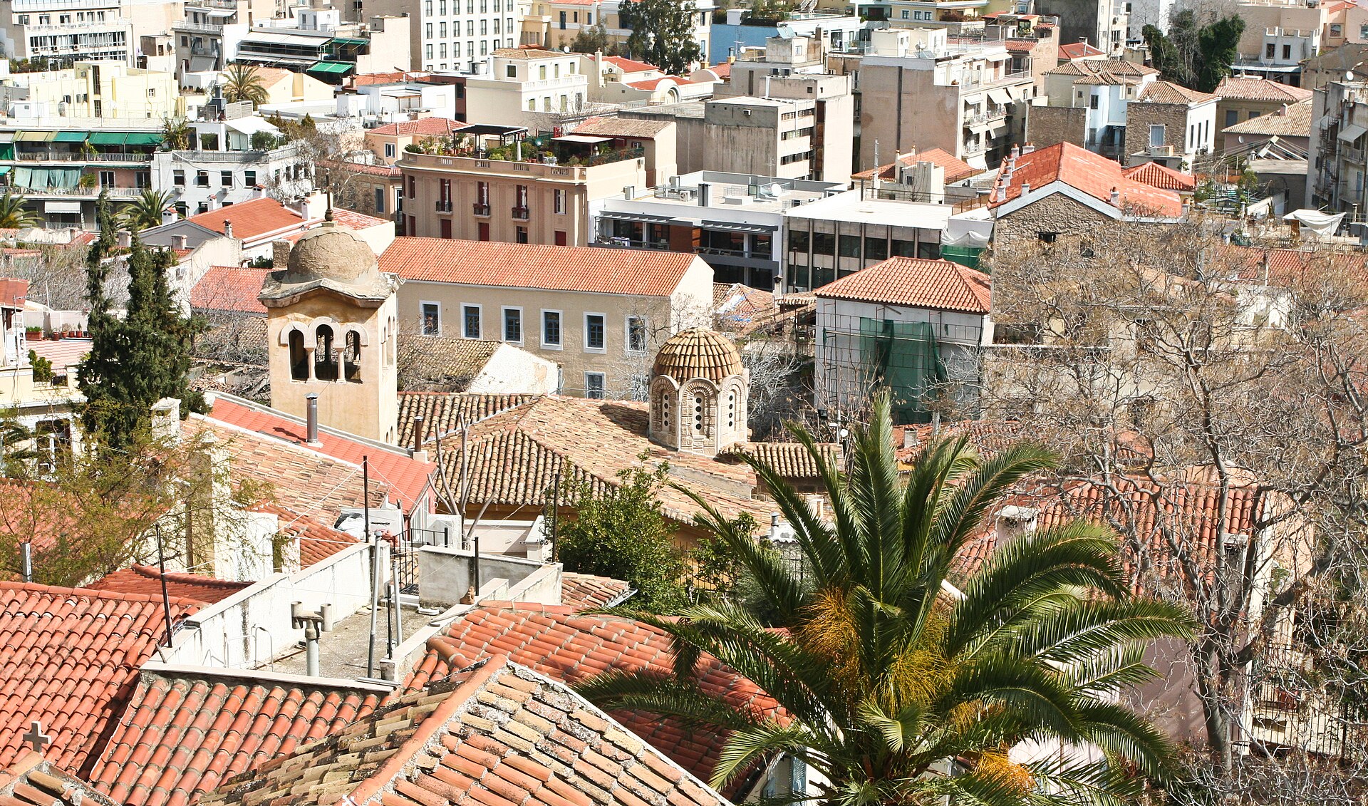
It is tempting to reduce Athens to a single silhouette: the Parthenon on its limestone crag, lit gold at dusk. That image is real and it is foundational, but it is also a small fraction of the place. Athens is simultaneously an ancient city, a nineteenth-century capital, a working Mediterranean metropolis, and a dense fabric of ordinary daily life. It is a city of memory and a city of the marketplace, of politics and the arts and the morning coffee at the same time.
Holding those layers together is the point. The traveller who arrives expecting only marble ruins misses the living city stacked around and beneath them, and the one who treats Athens as just another European capital misses how completely the deep past still shapes the streets. The honest way to read Athens is as a complete place of experience rather than a single monument with a city attached.
This guide keeps its centre of gravity on the Municipality of Athens and the historic core, where most first visits unfold. But it also reaches steadily outward into greater Attica, because the city only makes sense against that wider frame: the port of Piraeus, the Saronic shoreline, the mountains of Parnitha and Hymettus, Cape Sounion to the south, and the Mesogeia plain to the east.
A basin ringed by mountains
Athens sits in southeastern mainland Greece, in the region of Attica, of which it is the capital. The city is built across the Athens Basin, a plain hemmed in on three sides by mountains and open on the fourth to the sea. To the north and northwest rise Parnitha and Penteli; to the east stands Hymettus; to the west, Aigaleo closes the ring. Only the south is left open, where the plain slides down toward the Saronic Gulf.
That geometry is not a footnote. The mountains and the gulf together fixed a settlement in this exact spot for thousands of years, giving it defensible high ground, fresh water, farmland on the plain, and a sheltered route to the sea. The same ring of peaks that framed the ancient city still defines the modern one, and the famous Attic light, the clarity locals and visitors both remark on, comes partly from this enclosed, sun-struck bowl between rock and water.
Parnitha is the largest and highest of the Attic mountains and the wildest edge of the metropolitan area, a forested national park within sight of the city. Hymettus and Penteli flank the basin on the east and northeast; Penteli is the source of the fine white marble that built the classical monuments. Read the skyline in any direction and you are reading the geography that made Athens possible.
Hills as balconies over the city
Within the basin itself, a scatter of rocky hills breaks the urban grid and gives the flat plain its vertical drama. The Acropolis is the most famous, a flat-topped limestone outcrop rising about 156 metres around which the whole city grew. But it is one of several: Lycabettus, the tallest point in the centre, offers the widest panorama; the Hill of the Muses (Filopappou), the Pnyx, and the Areopagus form a quieter cluster to the southwest.
These hills function as natural balconies over the cityscape, and several carry political and civic memory as heavy as their views. The Pnyx was the meeting place of the Assembly, where Athenian democracy literally took place in the open air; the Areopagus served as an ancient council and court. To climb them today is to stand on the same ground where the city argued with itself, and to see, in a single sweep, how the modern metropolis pools around the ancient core.
For a visitor, this means the city is unusually legible from above. A short walk up Lycabettus or Filopappou reorients you instantly, showing the Acropolis at the centre, the mountains on three horizons, and the silver line of the Saronic Gulf to the south.
Open to the sea
The south of the basin is where Athens stops being a landlocked capital and becomes a coastal one. The plain runs down to the Saronic Gulf, and the historic port of Piraeus, fused into the metropolitan area, has been the city's maritime gateway since antiquity, linking it to the Aegean and the islands. The relationship between the inland city and its sea is one of the oldest facts about Athens.
Below the centre, the coastline unspools into the so-called Athens Riviera, a string of seafront districts and beaches running from Faliro south through Glyfada, Voula, Vouliagmeni, and Varkiza toward Cape Sounion. This is where the contemporary city goes to swim, walk, and eat by the water, and it reframes Athens as a place with a genuine summer coast rather than a purely archaeological destination. The redeveloped Faliro waterfront, anchored by major cultural and marina projects, has become a key public seam between the dense city and the gulf.
Geographically and culturally, then, Athens is a hinge: mountains at its back, sea at its feet, the ancient core in the middle. That position has always pulled the city in two directions at once, toward the land and toward the water, and it still gives a visit its rhythm.
A Mediterranean capital, and a capital of layers
Athens is the political, administrative, economic, and cultural heart of Greece, and it carries all four roles in a relatively compact footprint. The government, the courts, the universities, the museums, and the financial centre share the same dense grid as the markets, the tavernas, and the apartment blocks, which is part of why the city can feel so intense and so immediate at street level.
The climate is squarely Mediterranean: hot, dry summers, mild winters, and a long season of strong sunshine that shapes daily life as much as any monument. Athenians plan around the heat in July and August, live outdoors for much of the year, and treat the late afternoon and evening as the real working hours of social life. Visitors who lean into that rhythm, slow mornings, sheltered middays, long evenings, tend to understand the city far better than those who fight it.
Above all, Athens is a city of layers rather than a single era preserved in amber. The sacred rock of the Acropolis, the medieval churches, the neoclassical capital of the nineteenth century, the refugee neighbourhoods and apartment blocks of the twentieth, and the seafront and metro of today all coexist in the same square kilometres. Reading those strata, in stone and in street life, is the most rewarding way to understand where you actually are.
Reviewed source trail
- UNESCO World Heritage Centre — Acropolis, Athens - checked 2026-06-10
- Visit Greece (Greek National Tourism Organisation) — Attica - checked 2026-06-10
- Visit Greece (Greek National Tourism Organisation) — Athens - checked 2026-06-10
- This is Athens — the official Athens city guide - checked 2026-06-10
- Visit Greece (Greek National Tourism Organisation) — Mount Parnitha - checked 2026-06-10
Last reviewed June 10, 2026